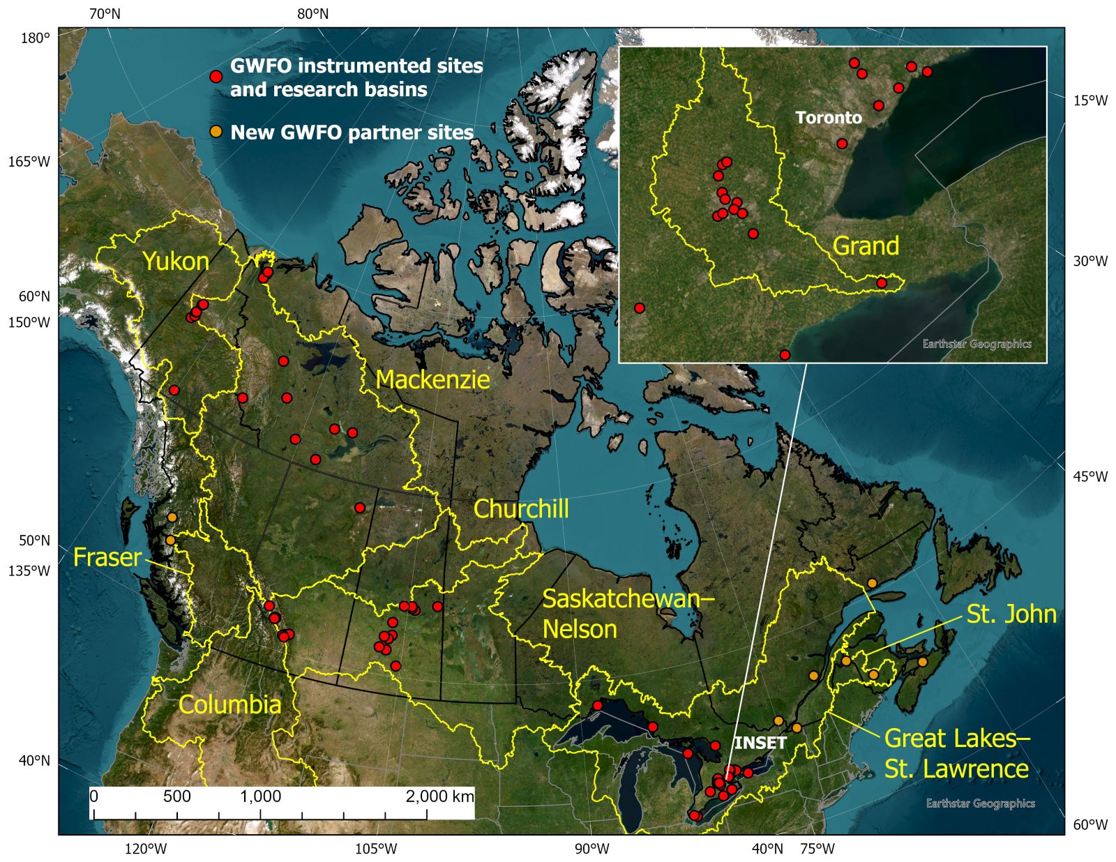
GWFO operates a national network of water observation sites that collect continuous and intermittent measurements of hydrometeorological conditions, water quantity and quality, ecological and biological indicators, contaminants, and other water-related variables. Some are long-term observatories with records spanning decades, while newer sites provide targeted observations in remote, data-sparse, and poorly understood regions, together delivering early warning of emerging water stresses and enabling detection of hydrological and water quality change. These sites and their data are available to scientific and operational users through established access and data-sharing policies, supporting improved understanding and decision-making in the face of climate change and other human pressures.
Great Lakes - St. Lawrence
Mackenzie River Basin
| Instrumented Site | Latitude | Longitude | Site Lead and/or GWFO Liaison |
|---|---|---|---|
| Athabasca Glacier Research Basin | 52.19 | -117.25 | John Pomeroy |
| Baker Creek Research Watershed | 62.58 | -114.43 | Jennifer Baltzer |
| Bogg Creek Watershed | 64.91 | -125.54 | Jennifer Baltzer |
| Bologna Glacier | 62.10 | -127.97 | John Pomeroy |
| Dehcho Lake Sampling Network | 61.25 | -120.48 | Heidi Swanson |
| Fire Ecology Network | 62.48 | -116.60 | Jennifer Baltzer |
| Havikpak Creek | 68.32 | -133.51 | Phil Marsh |
| Kakisa and Tathlina Lakes | 60.59 | -117.56 | Heidi Swanson |
| Peace-Athabasca Delta | 58.70 | -111.50 | Jennifer Baltzer |
| Smith Creek | 63.15 | -123.25 | Jennifer Baltzer |
| Tombstone Water Observatory - km 99 (Slavin Creek) | 64.71 | -138.41 | Sean Carey |
| Tombstone Water Observatory - km 104 | 64.75 | -138.37 | Sean Carey |
| Tombstone Water Observatory - km 175 | 65.21 | -138.32 | Sean Carey |
| Tombstone Water Observatory - km 185 | 65.29 | -138.23 | Sean Carey |
| Trail Valley Creek | 68.74 | -133.44 | Phil Marsh |
Nelson - Saskatchewan River Basin
Yukon River Basin
| Instrumented Site | Latitude | Longitude | Site Lead and/or GWFO Liaison |
|---|---|---|---|
| Tombstone Water Observatory - km 44 (Yin Yang Creek) | 64.31 | -138.47 | Sean Carey |
| Tombstone Water Observatory - km 71 (Black Shale Creek | 64.50 | -138.22 | Sean Carey |
| Wolf Creek Research Basin | 60.53 | -135.12 | Sean Carey |
Request Site Access
For access to any of our observation sites, please complete a Site Access Request by clicking below. We will get back to you by email as soon as we can.